

Search-area definition
The agreed geography, exploration question, and screening assumptions.
Rare earth targeting
MAINERAL helps exploration leaders decide which ground to pursue, where to focus field work, and which areas merit the next drilling budget in regolith-hosted rare earth exploration.
You receive ranked areas, candidate targets, and a defensible geoscientific rationale.
Built for juniors and mid-tiers making high-stakes ground and drilling decisions.
Public evidence at a glance
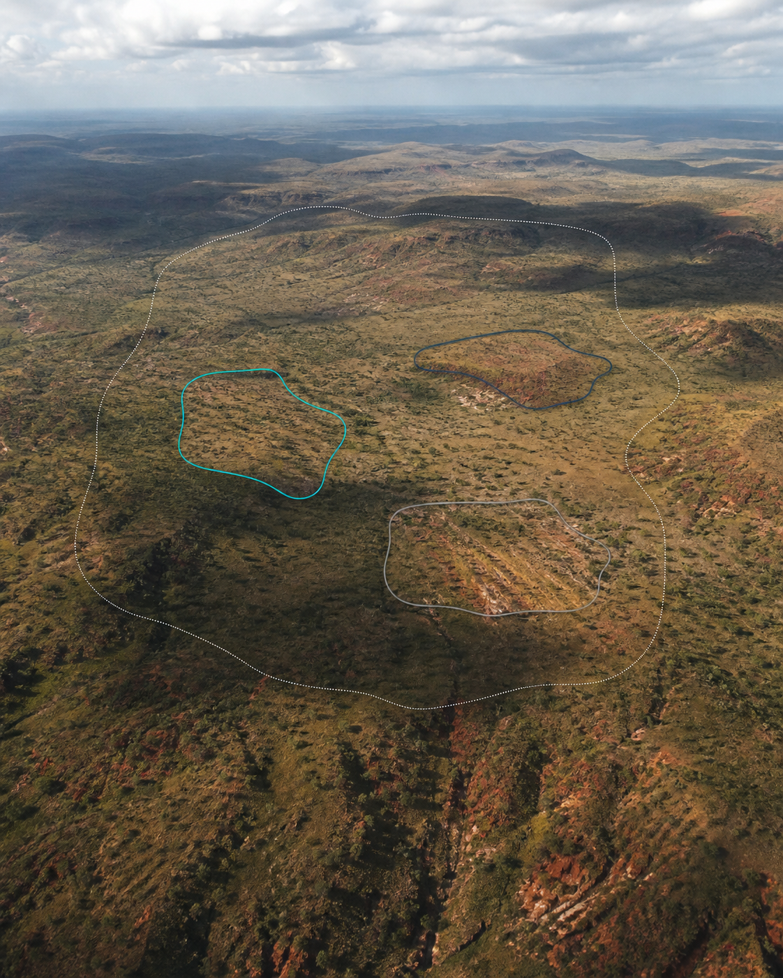
The 2022 targeting began as a blind validation, with reference locations withheld until the ranking was complete. The metrics also include a later comparison with 15 deposits reported after the work.
Method and limitationsSelected paid geospatial engagements
The decision before the drill
In regolith-hosted rare earth elements (REE), mineralization depends on more than the source rock. Weathering, landscape evolution, drainage, preservation, and access determine whether an area deserves field work and drilling.
A relatively low-cost drilling program can still destroy value when the wrong ground is chosen.
Where should we take ground?
Which areas deserve field work?
Where should the next drilling budget go?
What should we reject, and why?
The first engagement
A defined first engagement for teams screening a country or region, comparing acquisition opportunities, or deciding where field and drilling budgets should go.
One assessment, three common decisions
The agreed geography, exploration question, and screening assumptions.
Areas to pursue, compare, or discard before committing land and field budgets.
Prioritized areas for field follow-up and drilling campaign design.
Why areas were ranked, which assumptions matter, and what remains unresolved.
A practical sequence for field verification and the next capital-allocation decision.
A decision session for leadership and the technical team, supported by exportable outputs.
When contracted, rankings can be updated as relevant public or expressly authorized client data becomes available.
Illustrative deliverable structure
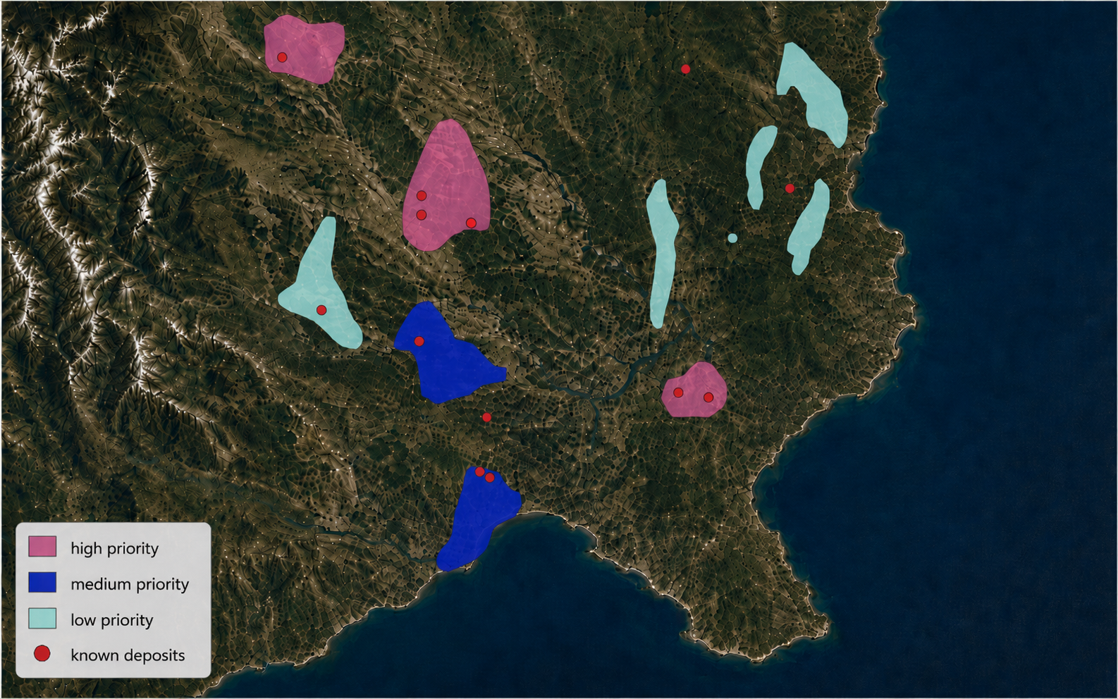
The public sample illustrates the engagement structure, from regional coverage to an auditable decision.
Illustrative sample · conceptual structure · coordinate-free
Decision rationale
Priority concentrates where source, weathering, preservation, terrain, and access evidence remain mutually consistent.
Recommended action
Advance the highest-ranked zones to field verification; hold medium-priority ground pending new evidence.
How an engagement works
Commercial scope and data handling are agreed before the technical work begins.
Define the general geography, exploration stage, and capital-allocation question using non-confidential project context.
Agree scope, confidentiality, ownership, permitted use, retention, and deletion before sensitive transfer.
Use public sources and expressly authorized client data to narrow and rank the search area.
Receive ranked ground, rationale, uncertainties, next actions, and an executive and technical readout.
Blind validation and follow-up evidence
The founders completed the 2022 Brazil targeting as a blind validation, with reference locations withheld until the ranking was complete. A later review compared that ranking with 15 deposits reported after the work. Eleven fell within ranked zones: eight in medium- or high-priority zones and three in low-priority zones. Four fell outside ranked zones.
Founders’ prior work
Before MAINERAL was founded, Aclara engaged our founders for regolith-targeting work across South America. Their 2022 delivery prioritized exploration areas in Brazil and ranked Goiás as the principal priority delivered to Aclara.
This engagement predates MAINERAL. Our founders provided the preceding targeting work; Aclara secured the concessions, executed the drilling program, and announced the discovery and subsequent project results.
Our founders delivered the regional targeting work.
Aclara entered an earn-in agreement over concessions in Goiás.
Aclara drilled 238 auger holes totaling 1,731 metres.
Aclara announced the Carina rare earth discovery.
From regional coverage to ranked ground
Founder-developed geoscientific logic and geospatial processing narrow large search areas into the places worth investigating.
Identify source rocks capable of releasing REE into adsorptive clays.
Remove areas with unsuitable preservation, drainage, water, climate, or access conditions.
Derive relevant terrain products from public geospatial and remote-sensing data.
Interpret landscape evolution and the potential preservation of residual regolith.
Score and rank the areas that remain after deterministic filters are applied.
Deliver ranked ground, candidate targets, and recommended next exploration steps.
Typical inputsPublic geology, elevation, remote sensing, climate, drainage, access, and client datasets when expressly authorized.
This public workflow describes the engagement stages. MAINERAL’s criteria, weights, and scoring logic remain confidential.
Paid geospatial pilots
Across three paid pilots, the team integrated multi-source data and delivered applied geospatial analysis in operational settings.
Selected to apply MAINERAL’s geospatial methodology to risk detection.
Testing predictive capability and multi-source data integration.
Integrated company, geographic, and physical data at large scale.
Three paid pilots since MAINERAL began operating in July 2025.
Selected programs
MAINERAL’s founding team has been selected for programs spanning early validation, B2B company building, venture acceleration, and mining innovation.
Current commercial focus
MAINERAL currently sells targeting outputs for regolith-hosted rare earth exploration. Other weathering-driven critical minerals are part of the future expansion roadmap.
REE · geospatial data · product

CEO
REE-regolith geoscientist with an MSc in Geosciences; currently a PhD candidate. Paulina co-developed the confidential targeting methodology and led the Aclara engagement that prioritized Goiás.
Architect of a US$236k FONDEF-funded REE innovation project; contributor to a US$4M CORFO-backed critical-minerals R&D program.

CTO
Mining Engineer with an MBA and MSc in Big Data & Business Intelligence. Yuri co-developed the targeting methodology and has eight years of experience building geology and mining data products.
32 products deployed across 5+ countries; prior initiatives reporting US$66M in impact for Anglo American and US$24M for CAP.
Advisors
Rare earth exploration
Rare earth commercial strategy
Data, AI, and model development
Buyer FAQ
No. Clients receive ranked outputs, supporting analysis, and the rationale needed to act. The underlying methodology and scoring logic remain confidential.
No. Targeting reduces and prioritizes the search space. Mineral exploration remains uncertain and requires independent technical judgment, field verification, and drilling.
Yes, when expressly authorized and governed by the engagement’s confidentiality, ownership, security, retention, and reuse terms.
MAINERAL currently sells targeting outputs for regolith-hosted rare earth exploration. Other weathering-driven critical minerals are part of the future product path.
Start with the decision
If you are screening a country, comparing acquisition opportunities, or preparing a regolith-hosted REE campaign, tell us the geography and the decision your team needs to make.
Call +56 9 8677 3885Use this form for non-confidential project context. Share confidential coordinates, targets, assays, and technical datasets only after written terms are in place.